Just recently, qian tour wing Q10 received a mountain line aerial survey task, the head is close to 600 meters above sea level, the part of the surveyed area close to 20 km in length, in order to ensure a safe and high quality mountain line aerial, often need a large number of survey work before departure, searched the whole area, more than to find the best landing point, because good landing point is mountain aerial half success!Q10, on the other hand, only used 1 sorties to easily complete field collection.
The drop of 550 meters is also 1:1000
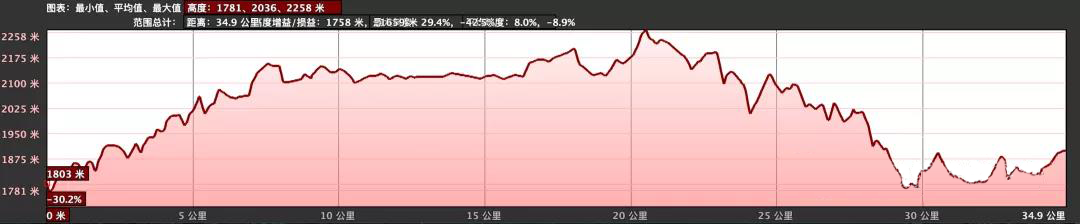
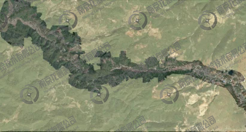
The length of the centerline of the entire line survey area is nearly 17 kilometers. In order to ensure the best quality of the data, the extension of both ends is 10%, and two routes are distributed along the centerline to both sides, a total of 4 routes.The altitude drop of the whole route is from 1,740 meters to 2,290 meters, reaching a drop of 550 meters.According to the center line of the line, the ground control software of Q10 automatically plans the navigation points and carries out elevation inspection to ensure flight safety. Finally, the average ground resolution is 5.93 cm, far exceeding the 1:1000 project requirement of the user.
The 17-kilometer length also required one flight
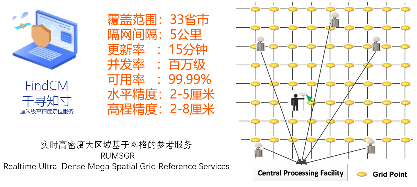
The Q10's radio has a nominal communication range of 15-20 km.Generally speaking, the communication distance of the radio station is affected by signal interference, and the influence of access occlusion will often make the actual communication distance greatly reduced. However, the three-in-one radio station adopted by Q10 still maintains 100% signal strength 19 kilometers away from the radio station in this task, which provides an important guarantee for network RTK navigation of FindCM!
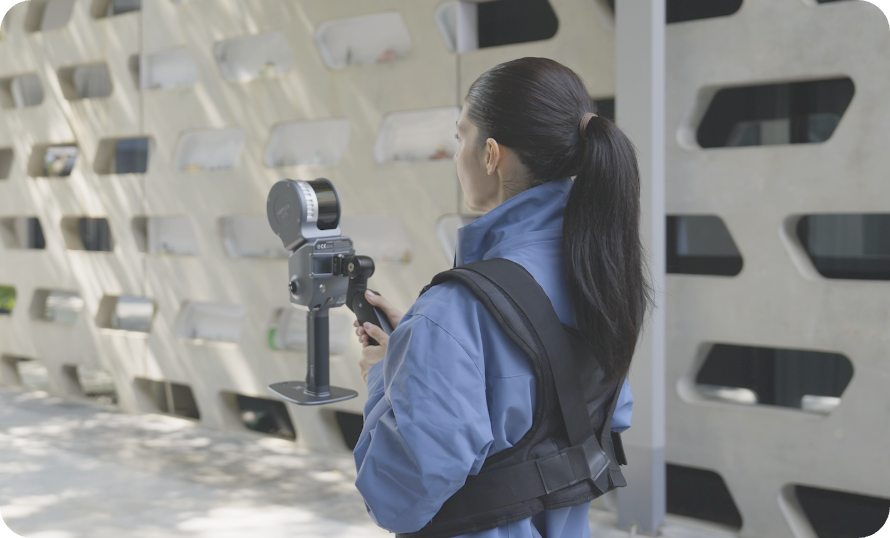
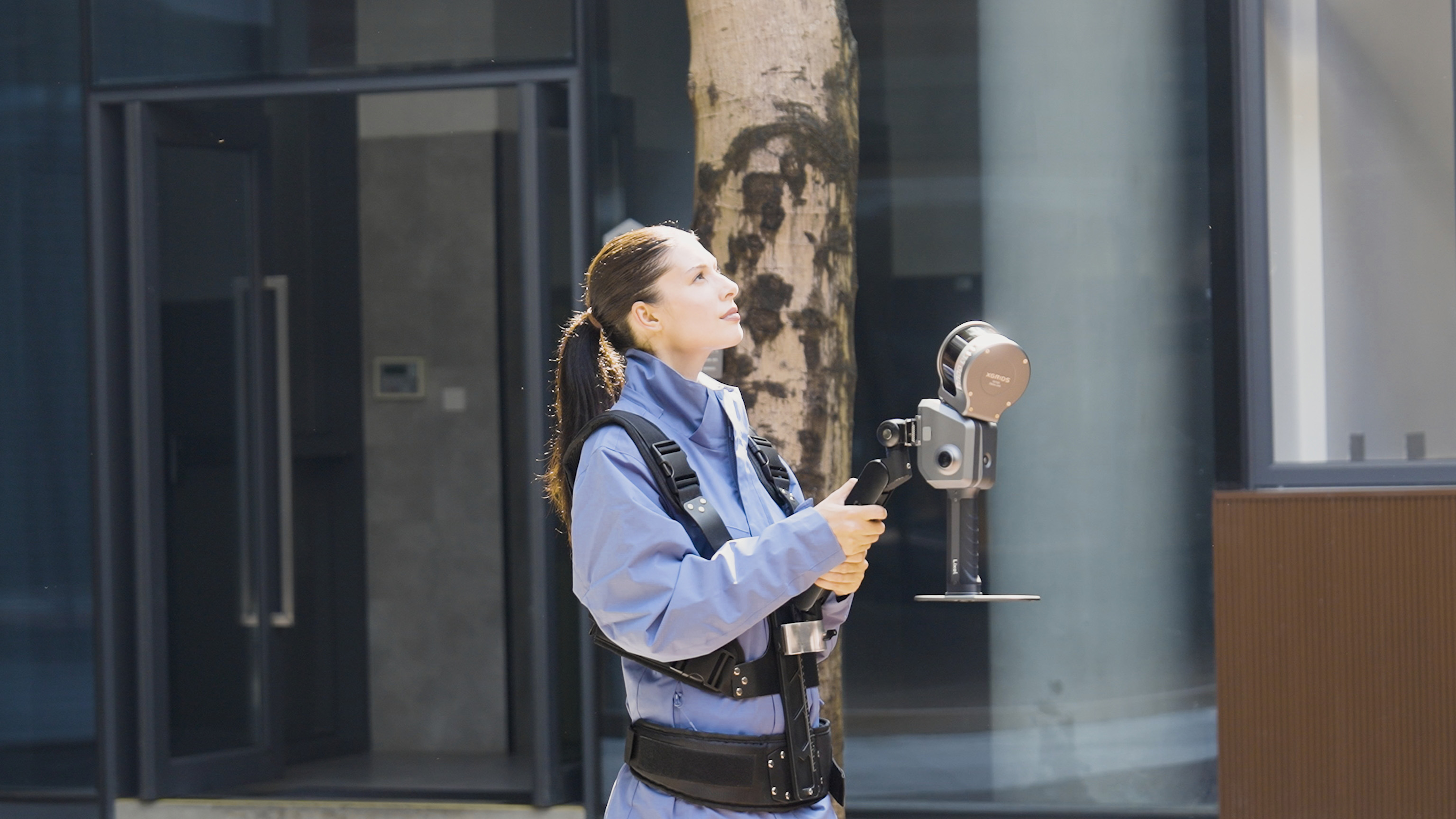
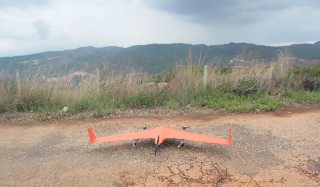
Mountainside trails can also be used for successful takeoff and landing
Traditional fixed-wing UAS usually spend a lot of time to survey and survey areas for taking off and landing points. In order to guarantee the communication quality and safety, a survey area is often divided into several routes for operation, which greatly reduces the overall efficiency of operation.Even with vTOL uAVs, it is necessary to choose open areas and accurately aim at the wind to ensure the safety of taking off and landing.
Due to its excellent flight control capability and the optimal lift-to-drag ratio design of delta wings, Q10 chose to sail on a path on the mountainside regardless of wind direction, which greatly alleviated the pressure on the choice of take-off and landing points. This is also an important ability to quickly carry out operations after a simple survey of the scene!
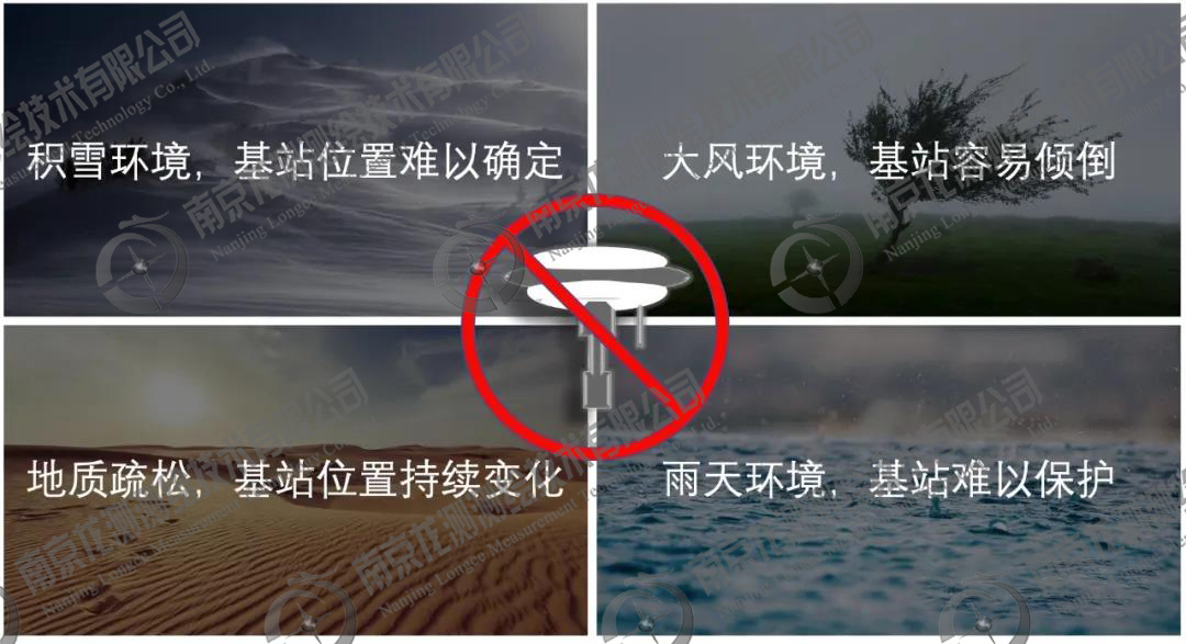
Generally speaking, the accuracy of PPK of a single base station is very limited by the solution distance.
For high-precision PPK, it is not recommended to exceed the range of 10 km, which leads to the long distance aerial survey has to collect a large number of image control points to make up for the lack of PPK accuracy.Q10 adopts the GPPK technology based on the cloud based on the positioning FindTrace, and takes advantage of the strong advantage of having one network in the country and unified coordinate datum to realize the POS results with 2-5cm accuracy regardless of the operating range without on-site GNSS base station assumption and through the intelligent networking algorithm of more than 2,400 Beidou ground reinforcement stations in the country.
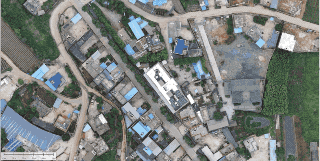
Orthophoto image
Through the cloud processing of FindPixel, the rapid creation of orthographic image, digital surface model, OSGB 3D model and other achievements can be easily achieved.And all the results can be superimposed on all kinds of existing results for multi-time comparison.As can be seen from the comparison below, in addition to the qualitative improvement in resolution,
DOM data of Q10 can be consistent with Google Earth satellite image with high precision, and DOM can achieve the true radiation level without backward direction, so that such a big drop is free of pull out, vulnerability, deformation and other conditions.
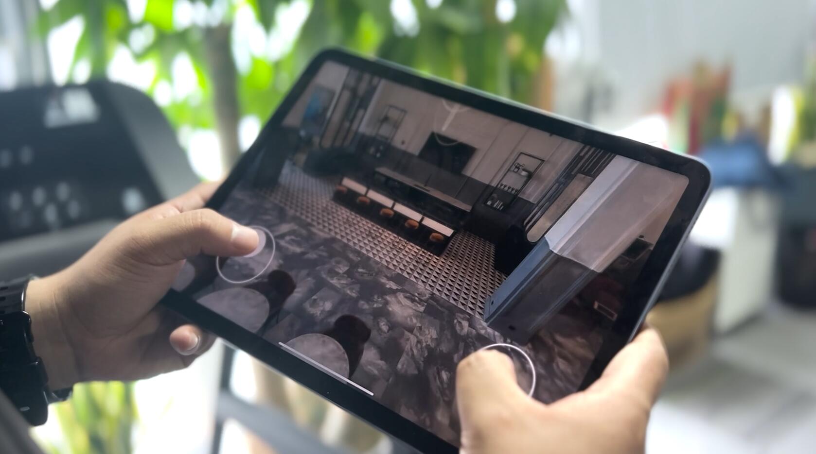
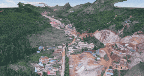
OSGB 3D model
Although the Q10 is loaded with a 42-megapixel full-frame single-lens load, it can still reconstruct high-quality 3D models for display and simple stereo analysis:
With the excellent aerophotogrammetry foundation of the technical team, only two days of Q10 training can complete such a difficult real operation.On the one hand, it benefits from the excellent design experience of Q10, and more importantly, it is inseparable from the professional quality of the New Coordinate team.With such excellent partners, we believe that Q10 can shine in the colorful Cloud South, for the majority of users to bring excellent intelligent flight experience!
 ∷
∷ 

.gif)
 Sweep WeChat yards pay attention to us