Modeling Technology of tilt photography for unmanned aerial vehicle
The Oblique Photography Modeling Technology Fully perceives the complex scene in a large-scale, high-precision and high-definition way, the data produced by efficient data acquisition equipment and professional data processing process can directly reflect the appearance, position, height and other attributes of the objects, which can guarantee the real effect and the precision of surveying and mapping. At the same time, the production efficiency of the model can be improved effectively. The modeling of a small and medium-sized city, which can only be completed in one or two years by manual modeling, can be completed in only three to five months by means of oblique photography modeling, the economic cost and time cost of 3D model data acquisition are greatly reduced.
MODELING ADVANTAGES OF OBLIQUE PHOTOGRAPHY:
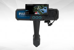
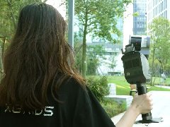
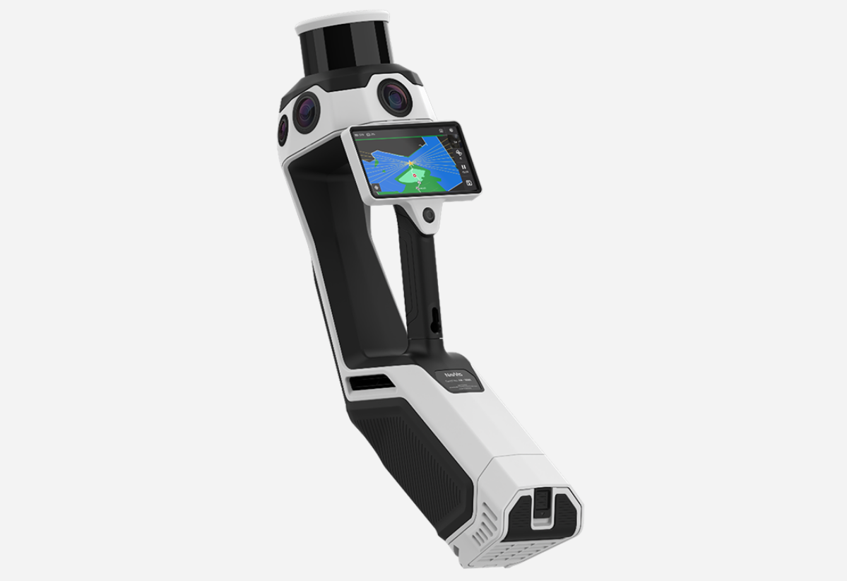
Multi angle image acquisition (one vertical, 4 / 6 tilt angles)
It can fully express the spatial features and make up for the deficiency of Orthophoto
It can meet the requirements of 3D modeling and traditional aerial survey at the same time
The output of data is osgb / tdom / DSM / 1:500
Short cycle, high efficiency, high precision modeling, fast acquisition, safe and reliable, easy to operate and easy to carry
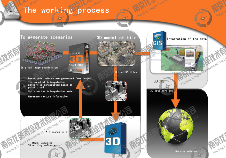
Flow chart of oblique photography modeling:
The application of oblique photography modeling technology
Bim and urban planning
Automatic modeling technology can quickly establish the true three-dimensional model of the city, provide data basis for digital city construction and three-dimensional navigation electronic map, and provide more intuitive and accurate technical services for government departments at all levels.
Earthquake relief
The UAV tilt 3D modeling technology is used to quickly obtain disaster data and make inclined 3D model for geological disaster site. The whole process from take-off to final model output only takes a few hours. It can truly reflect the disaster situation and bring its own elevation information and texture information, which greatly reduces the workload of field investigation and greatly shortens the time for the command level to understand the situation of the disaster area The emergency working group can quickly make feasible emergency relief plan.
Cultural heritage protection
Large scale cultural heritage status information acquisition, dangerous area estimation, repair work simulation, workload estimation, construction difficulty evaluation, etc., such as the great wall protection, historical ancient town mapping, etc.
Tourism, culture, film and television industries
UAV tilt 3D modeling technology provides low-cost, efficient and agile data support and services, and improves the ability of flexible and rapid acquisition of fine 3D data. The application results have been applied and verified in tourism, culture, film and television industry, and have been praised by users, which has an important demonstration role and promotion value.
Military reconnaissance, anti-terrorism, public security, fire control
UAV tilt three-dimensional modeling technology can realize the real-time monitoring of fire-fighting facilities position level operation status, real-time monitoring of fire-fighting fire scene, real-time display of the scene situation through the 3D GIS platform to assist fire command, so as to improve the rapid response ability of fire forces, improve the government's public fire service level, and enhance the safety and image of the city.
It can realize seamless linkage of urban public security and traffic management, realize rapid police dispatching, and improve police management means for public security work in Colleges and universities.
Water conservancy, electric power, highway and railway
Monitoring of water conservancy levee, safety management of water conservancy project, reservoir monitoring, planning and site selection of water conservancy facilities, and deduction of emergency plan. Power line patrol, power facilities planning and site selection, power line tower hazard warning, etc.
The site selection before railway and highway planning, the control and rush construction of occupied villages, the assessment of crossing mountainous areas and tunnels and the estimation of engineering quantity, the regular inspection of the built facilities, the early warning of potential safety hazards, etc.
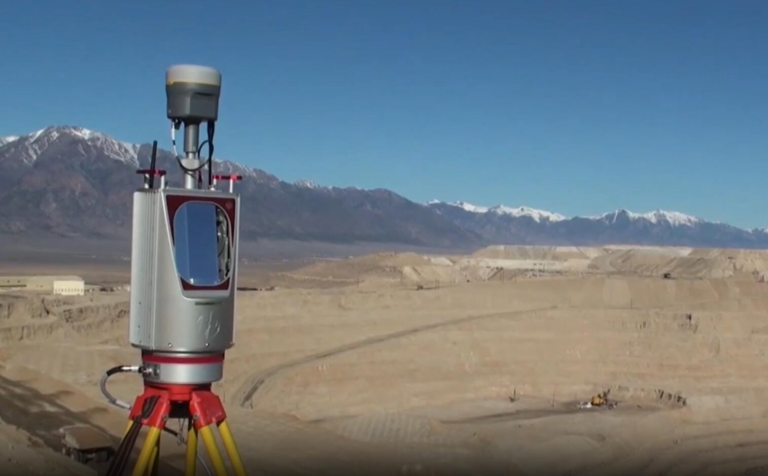
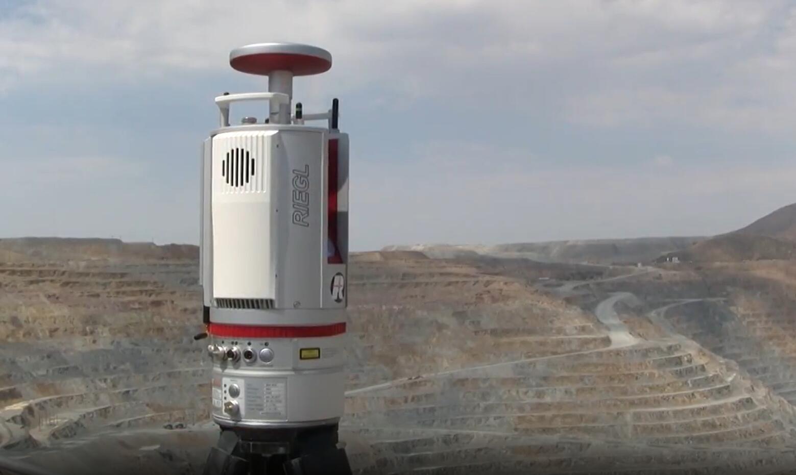
Mineral resources, oil pipeline
Open pit mineral resources assessment, mining workload estimation, mining progress monitoring, earthwork calculation after multiple mining, risk assessment, mining plan planning, etc.
Oil pipeline planning and site selection is always a very laborious and laborious work, and it takes a long time. UAV tilt photography plays an important role in field data collection, pipeline inspection and safety hazard investigation.
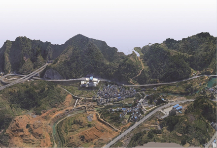
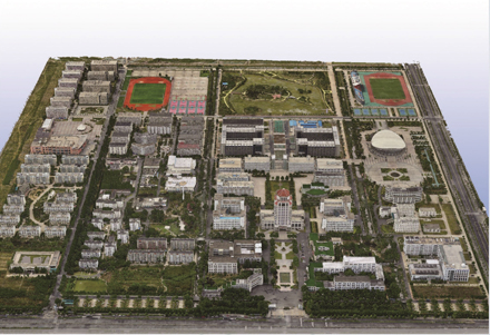
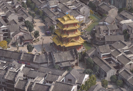
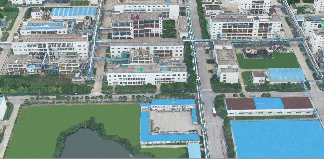
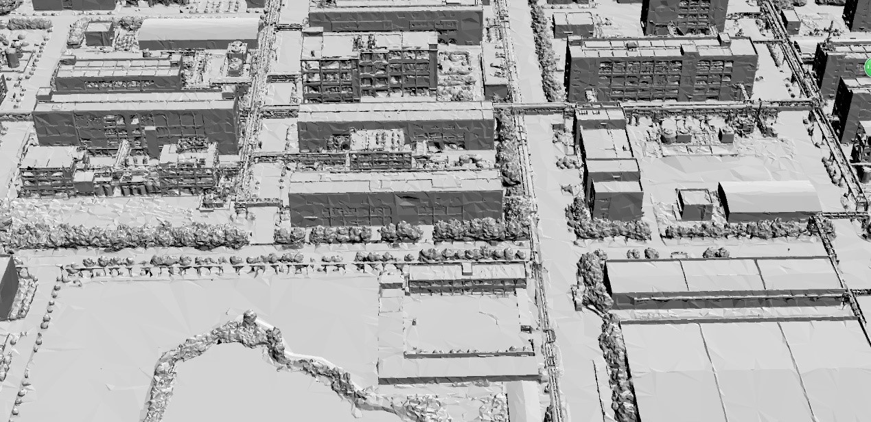
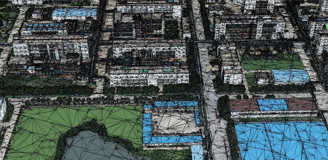
Tilt photography model effect:
3D texture mapping model
Tin white model
Tin with high precision
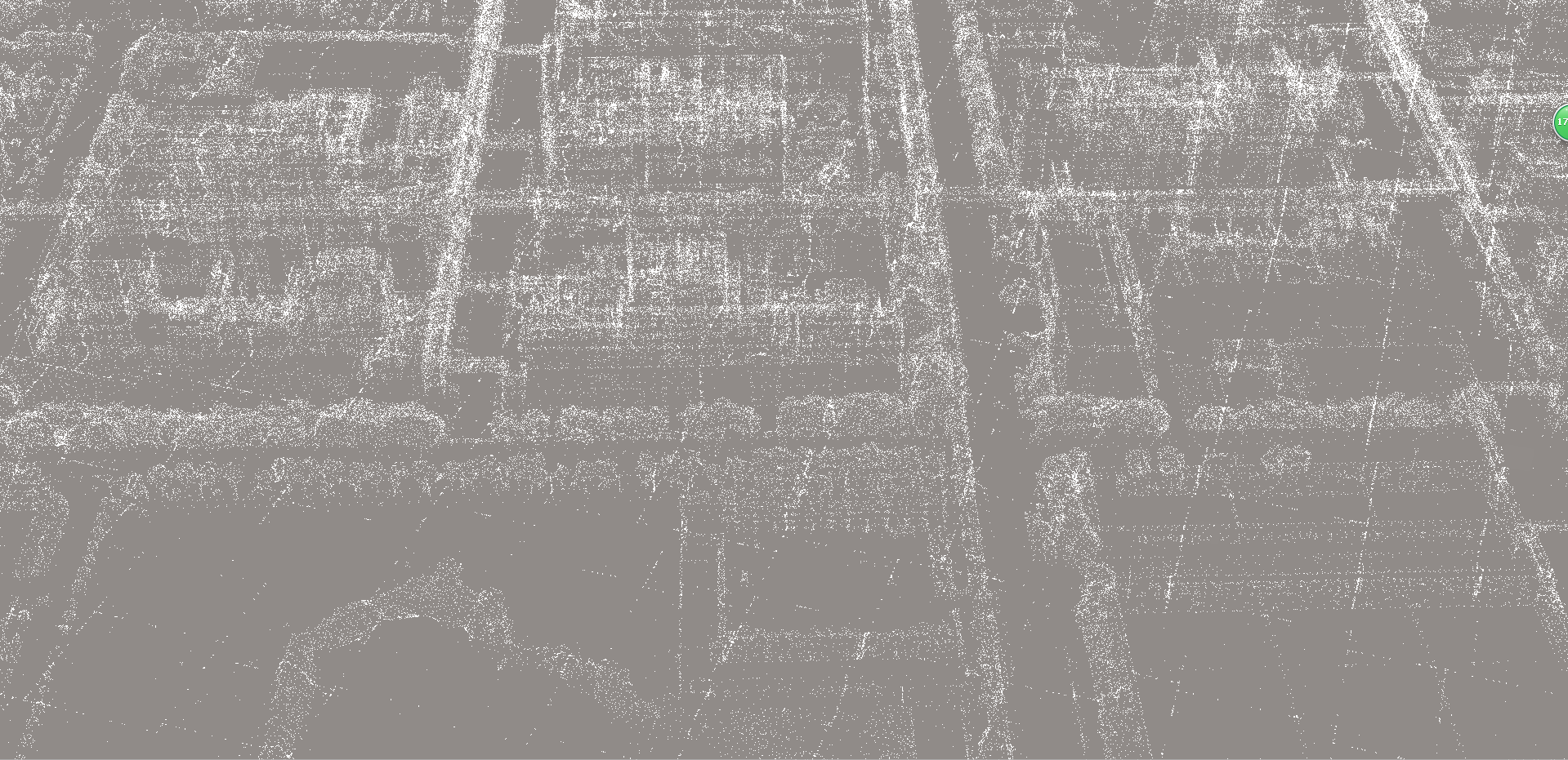
3D point cloud data
 ∷
∷ 


 Sweep WeChat yards pay attention to us